

A road map of Idaho, if you focus on the narrow strip of land that sits atop the main bulge of the state, will show US 95 extending upwards from the town of Lewiston on the Snake River and running due north until it touches British Columbia. US 95 is the only north-south road in the state; for most of its five-hundred-odd miles, its major function is commercial. On it, apart from a few weeks in the summer at the height of the vacation season, wheat and wood chips move south to the granaries in Moscow or the pulp mills in Lewiston, logs by the tens of thousands head north to the lake towns of Coeur d’Alene, Post Falls, and Sandpoint. On that map, halfway between Moscow and Coeur d’Alene, several miles above a couple of minuscule settlements designated, echoically, Desmet and Tensed, a thin blue line splits off from US 95 and runs due east for twenty miles until it dead-ends in Idaho 5 coming north from St. Maries.
Nothing much shows on that road big enough to be named; it starts from nowhere, goes to noplace. Travelers on it turn their backs on the rolling grainlands of eastern Washington and head toward a low wall of mountains, smooth, rounded, thick with timber. The change in topography is instantaneous. In less than two miles they’re in the foothills of the Bitterroots, the westernmost range of the Rocky Mountains, scarcely seventy-five miles from the Montana border. Once over the first row of hills the road descends again and presses deeper into those foothills for fifteen miles or so, following alongside the Benewah Creek and through the Benewah Valley.
Houses and landmarks on that road are few. It’s a gravel road, in theory at least, but for much of its length it’s better described as a dirt road backed up with whatever rocks nature or the Benewah County road crew found time to strew there. “I lived here better than twenty years,” the owner of Benewah Motors, Wally Krassalt, once told me as we made our way from town out toward my place to diagnose my ailing Land Rover, “and I never once saw the Benewah Road in good shape.”
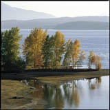
Much of the time the road follows alongside the Benewah Creek, running slightly above the creek through draws filled with alder and aspen or traversing occasional flatlands and pockets of deep forest. You drive along the road with no real sense of progress. It’s hard to mark the miles: there are no towns to encounter, no height toward which to aspire, just a succession of curves and glimpses of fields and pockets of forest so similar that they are valueless as landmarks. If you pursue the Benewah Road almost to its terminus at State 5, you come upon a dumpster, angle-parked on a turnout on the downhill side of the road, positioned so that as you discard your trash you may look out and down at a post-card view of the southernmost end of a chain of glacial lakes that stretch from St. Maries north almost to Canada. On most days the dumpster overflows with abandoned household goods, broken bedsteads and electrical components, scraps of carpet and sheetrock and lumber, random tools or parts of tools, bald and shredded tires, pieces of cars. At one time some local wag took a can of bright orange paint and sprayed “Benewah Shop-n-Save” on the side of the dumpster. Like all good humor, it had one foot in reality; my neighbors and I checked that dumpster regularly, like a lottery ticket.
Long before you encounter the dumpster, though, if you are headed east from US 95, you pass a spot marked on your map as “Benewah.” Maps denote “Benewah” with a small blue circle, as if to promise travelers a settlement of some kind or other situated about midway along the road, but the maps promise more than ever existed. Even in the heyday of north Idaho logging and homesteading, there never was a town named “Benewah.” The place is recognizable as a civic location only because of two buildings, an abandoned one-room school, painted, the time I first saw it, bright pink, and a swaybacked frame structure with a faded sign, “Benewah General Store,” and because of a smaller dirt road that dead-ends at the Benewah Road just east of the schoolhouse. Less than a hundred yards along that lesser road a sign cautions you that there should be “No Heavy Hauling When Surface is Soft.” In one instant, if you read it attentively, that sign tells you much about the local climate and economics as well as the politics and favorite pastimes of the people who live there. The sign, like every other sign the county erected along that road, is riddled with small holes; it’s an instance either of vandalism or of “bullet art,” depending on your point of view. As you pass by the sign the road begins to climb out of the valley and heads into the timber. Now you’re on the road to Alder Creek.
Next > > > “We bought forty acres of land . . . ”